
THE RIMROCKER TRAIL
As described here the Rimrocker Trail was traveled from east to west – Montrose to Moab. Mileage and GPS waypoints are provided for additional guidance. The coordinates and mileages are approximate, so watch for signage and consult your maps.
Part 1 – Montrose to Nucla
Part 2 – Nucla to Highway 141
Part 3 – Highway 141 to the Colorado-Utah state line
Part 4 – Colorado-Utah state line to Moab.
1Part 1 Montrose to Nucla
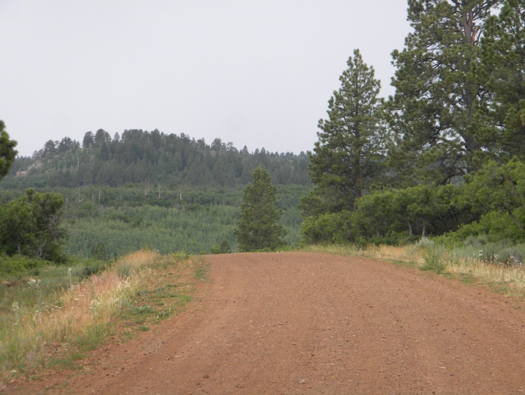
To access the Rimrocker Trail, head west from Montrose on Highway 90, which initially follows East Main Street and then Spring Creek Road. Continue to follow Highway 90 (several 90 degree turns) to the end of pavement where 90 Road begins. There you will find a nice large flat staging area (GPS N38 25.833 W107 59.116) which is perfect for off-loading OHVs & dirt bikes, airing down 4×4 tires, etc. However, it currently has no facilities. Before leaving the staging area reset your trip meter to zero. When leaving, turn left on 90 Road and you’re on your way. You’ll shortly see the first Rimrocker Trail signpost, which is fluorescent green – as are all the trail signposts outside of the national forests. The trail begins to travel up and over the Uncompahgre Plateau on a good graded dirt road. The Uncompahgre Plateau is a long narrow flat-topped fault block about 25 miles wide and 100 miles long. The Rimrocker Trail reaches a high point of 9,840’ elevation at the crest of the Plateau, by means of a gradual climb.
As you enter the Uncompahgre National Forest (approximately 11.7 miles from the staging area) you’re already at 9,000’ elevation. Continuing onward, the trail signposts within the national forest are brown. They are a little harder to spot, but keep an eye out – the trail remains well marked. It should also be noted that although you are still on 90 Road it is now signed as Forest Service Road (FSR) 540. Continue to follow FSR 540 through aspen and pine forest with some open meadows. At approximately 14.5 miles FSR 402 (aka Divide Road) joins from the left – continue straight on FSR 540/402. At 15.2 miles FSR 540 (aka 90 Road) diverges to the left – continue straight on FSR 402 toward Columbine Pass.
At various times and in various places we have seen deer, elk, fox and coyote along the route between Montrose and Nucla. A word of caution – during the warm seasons some of the forest is open cattle range and firewood cutting and logging are allowed. Be on the lookout for cattle, woodcutters, and logging trucks.
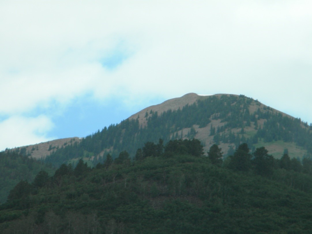
From there continue northwest on Forest Road 402, and begin a long gradual descent. FSR 402 provides access to several other roads which are well worth taking time to investigate. Some of our favorites include the Roubideau Jeep Road (a loop on Fence Line Road, FSR 544, and Traver Mesa Road) and the Monitor Mesa Loop (on Monitor Mesa Road and 7N Road near Columbine Pass), both of which are shown on the paper and online maps. An important left hand turn is at Columbine Pass (GPS N38 25.025 W108 22.8778), approximately 30.8 miles from the staging area, onto FSR 503 (aka 25 Mesa Road and the Delta-Nucla Road). The descent will become more pronounced as you travel down off the crest of the Uncompahgre Plateau toward Nucla. Your views to the west will begin to open up, with Lone Cone Mountain standing out on the horizon.
At 47.1 miles from the staging area you will leave the national forest and hit pavement on 25 Mesa Road (aka the Delta-Nucla Road), which is an approved OHV route to Nucla. Continue on 25 Mesa Road and turn right on East 4th Avenue (GPS N38 16.204 W108 32.207). At 53.3 miles from the staging area turn left onto Main Street and head south. Driving time from Main Street, Montrose to Main Street, Nucla is about two hours.
2Part 2 Nucla to Highway 141
Traveling south through Nucla you will pass the Fifth Avenue Grill, a small grocery store, and further on a gas station. Additional services such as a motel, convenience store, car wash, and visitor center are available about 4.5 miles further south in Naturita. Note: if you will be continuing on beyond Highway 141, this is your last chance for gas. Considering filling up in either Nucla or Naturita. To continue on the Rimrocker Trail turn right (west) on West 10th Avenue at the City Park ( GPS N38 15.694 W108 32.762) and reset your trip meter to follow mileages in this article.
From Nucla City Park head west out of Nucla, at which point the road changes to CC Road. From there the Rimrocker Trail makes a series of 90 degree turns (2700 Road, AA Road, 2600 Road, and Z26 Road) before the pavement ends at 6 miles from Nucla City Park. There is an important left turn at 7.7 miles, where Z26 continues north and the Rimrocker Trail turns west on V19 Road. The turn is well marked even though V19 is not as well maintained. This part of the Rimrocker Trail crosses areas known as Second Park and Third Park, through both public land and private property. Please respect the landowners’ rights and stay on the designated road. As you travel north and west along the mesa top, there are views of the Uncompahgre Plateau to the east, red rock canyons to the west and the La Sal Mountains farther west in Utah. Although you can’t see them, you are paralleling Highway 141 and the San Miguel River. As a side note, an informative pamphlet about the scenic drive Highway 141 from Naturita to Gateway is available. This guide is available in the visitor center at Naturita.
There are a couple of other important turns along the way – the trail continues down into a canyon after a sharp right at 15.3 miles, and at 22.3 miles continue to follow the signs to the left onto a less maintained road.
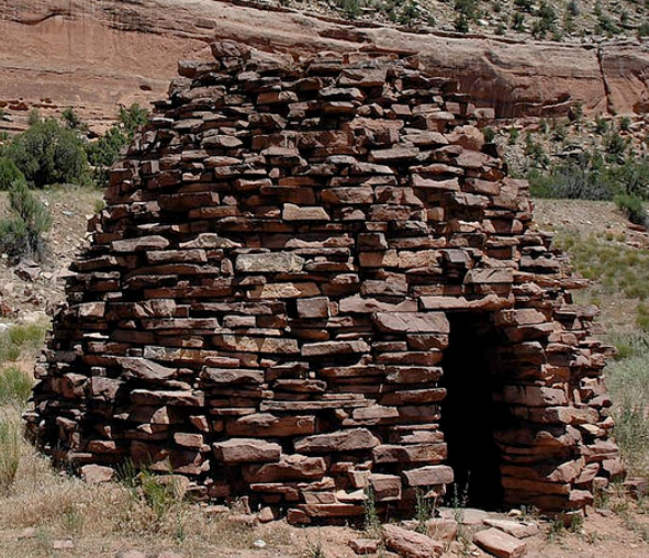
At 26.5 miles from Nucla you will to enter the Uravan mining area, which extends west across Highway 141 toward Utah. In fact, the namesake of the trail, “Rimrocker”, was a name given to the people who worked the many mines in this area. The mines included the Joe, Sandy, Fox, Dolores, Club Sandwich, Last Chance, and the Ophir, to name only a few. At this point, I would be remiss if I did not say a few words about the mining. The area is rich in carnotite ore, which contains radium, vanadium and uranium. The name Uravan is derived from a combination of the words uranium and vanadium. In the early to mid 1940s, the U.S. Vanadium corporation built a mill at Uravan to process carnotite ore into uranium oxide, aka yellowcake. The yellowcake was sent elsewhere in the country where it was enriched into pure uranium, some of which was used in the atomic bombs that ended World War II. Because of the mining and the mill, Uravan continued to prosper until 1971, when the federal government stopped acquiring uranium and the price of yellowcake began a steady decline. Additionally, construction of new nuclear power plants declined and uranium stockpiles were sold, both of which contributed to a further decline in the price of yellowcake. With the uranium mining industry in a bust, the Uravan mill was closed in 1984 and a Superfund cleanup was begun to mitigate the radioactive town and millsite. The town closed in December 1986 and was entirely razed. Today you can drive through the townsite and up past the mill site, seeing only faint hints of what was once there.
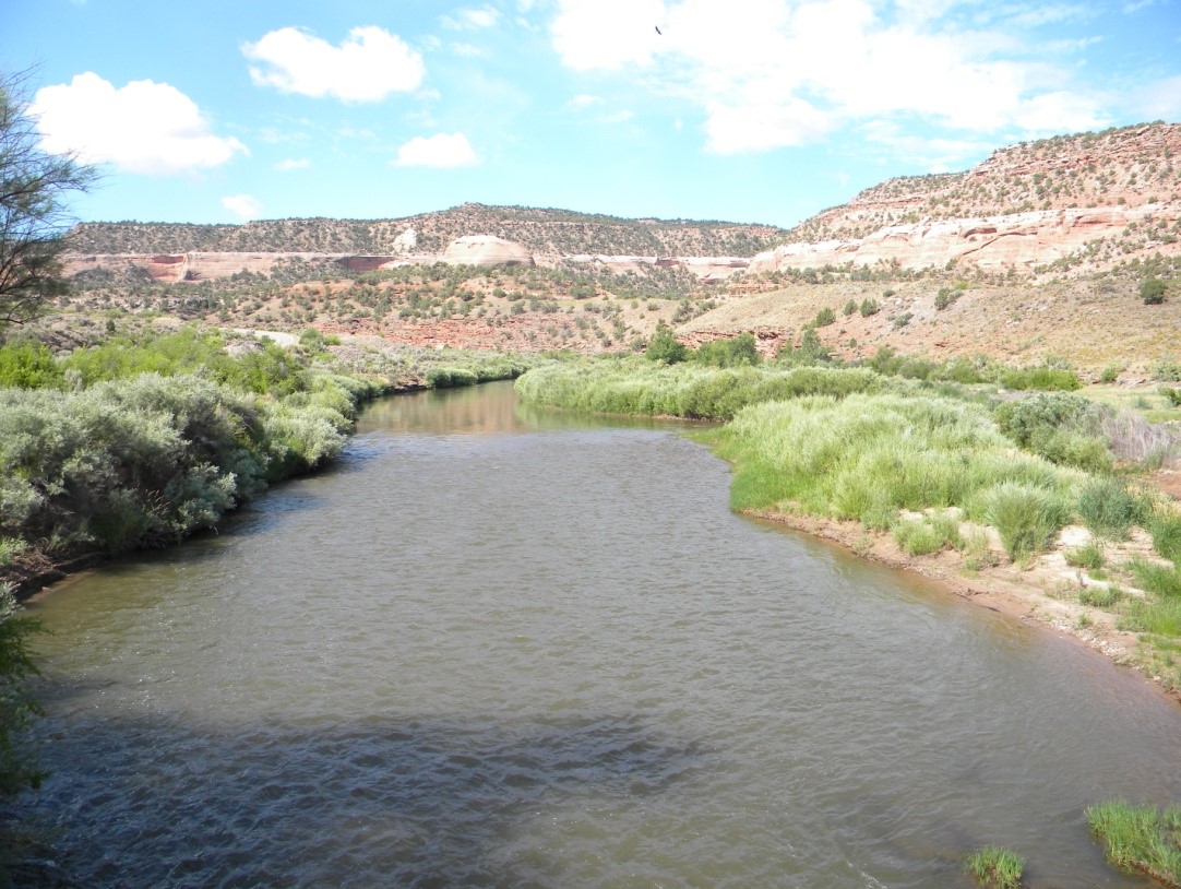
Continuing north and west toward Highway 141, the Rimrocker Trail drops down into a 50 foot thick layer of Navajo Sandstone, which is the same frozen-sand-dune rock layer in Utah and other Colorado Plateau scenery. The trail continues to parallel Highway 141 and eventually the Dolores River too. The views to the north and west really open up and the erosion of the river through the sandstone is amazing. Next are a short section of shelf road, a couple of sharp turns, a downhill section, a flat area, and 34.5 miles after leaving Nucla you are at the intersection of Highway 141 and Q12 Road (GPS N38 25.573 W108 49.39).
Driving time from Nucla City Park to Highway 141 is about 2 1/2 hours.
Just as in Part 1, the Rimrocker Trail in Part 2 also provides access to many other roads and trails which adventuresome folk will find worth investigating. Among them are the Monogram Mesa Loop / Bull Canyon Tour; EE22 Road, which will take you through the Uravan townsite and millsite near the San Miguel River; and Y11 Road, which will take you along the San Miguel River past the Hanging Flume, to the confluence of the San Miguel and Dolores Rivers, and west through the Dolores River Canyon and into Paradox Valley.
With so much rich history, a mining past, and exposed layers of sandstone geology, it’s no wonder this area is so reminiscent of Moab, UT. The next time you’re headed to Moab, consider starting in Montrose and running the Rimrocker Trail. With access to many side trails and the other trails in the Montrose and Nucla / Naturita areas, you just may not get to Moab at all!
3Part 3 Highway 141 to the Colorado-Utah State Line
If you have traveled the route as described in Part 2 and have arrived at Highway 141, turn left onto the highway and proceed south for 1.4 miles to continue on the Rimrocker Trail. Turn right on R13 Road, zero your trip meter, and cross the bridge over the Dolores River (GPS N38 25.573 W108 49.39).
An optional side trip for street legal vehicles is to continue past R13 Road on Highway 141 for approximately 0.6 miles to a right turn to an old coke oven located between the highway and the river. The oven was built in the late 1800s to convert green coal into coke coal, which burns much hotter with almost no smoke. The coke from this oven was likely used by blacksmiths who forged iron for the construction of the Hanging Flume.
Continuing the side trip southward on Highway 141, go 1.7 miles (past mile marker 82) to a pullout and overlook of the Hanging Flume, which is below the highway hanging off the rock wall of the Dolores River channel (2.3 miles from R13 Road). Construction of the Hanging Flume started in 1887 and was completed in 1891. The flume was to provide water under a head of pressure for the Lone Tree Placer Mine’s hydraulic mining operations along the banks of the river. Some of the wood used to build the flume came from timber cut on Pine Flat and Carpenter Ridge near Buckeye Reservoir. The Rimrocker Trail eventually passes through both of these areas. The timber that was cut on Carpenter Ridge was hauled down to the river on a portion of the Rimrocker Trail to Red Canyon, and then down Red Canyon to a ford of the river.
This side trip can be extended even further by continuing southward on Highway 141 another 1.25 miles (3.6 miles from R13 Road), to an unmarked right turn (GPS N38 22.99 W108 48.20) after a sharp curve after mile marker 81. Follow the trail a short distance to an overlook of the confluence of the Dolores and San Miguel Rivers.
If you have elected to spend an extra day (or even two) exploring in the Nucla-Naturita area, there are even more places to explore. You can pick up brochures for the following at the Naturita Visitor’s Center: The Wild Horses of Disappointment Valley, Long Park Mine Tour, Bull Canyon Tour, and Paradox Valley Petroglyph Tour. Other options farther afield include Forest Service Road (FSR) 512 (aka Hanks Valley Road) and FSR 557 (aka Horsefly Point Road) are both relatively easy “in and out” trails which start off of Sanborn Park Road, northeast of Norwood.
If you have spent some time exploring these roads and are ready to continue on the Rimrocker Trail, you can reach it from Naturita by heading north on Highway 141 approximately 23.9 miles to R13 Road, just beyond mile marker 84. Once there, turn left, zero your trip meter, and take the bridge over the Dolores River (GPS N38 25.573 W108 49.39).
In any case, there is plenty of room just across the R13 Road bridge over the Dolores River – to regroup with trail mates, air down your tires if desired, or just take a few minutes to enjoy the scenery. Continue on the Rimrocker Trail around to the left on the main road. After passing through the gap in the fence, bear right at the Y intersection onto Q13 Road. The road to the left goes out to a local landmark named Biscuit Rock. Although there is very little shade in the area, it is interesting to explore. You can continue past Biscuit Rock to several old buildings, which are all that is left of an abandoned mining development.
Back on the Rimrocker Trail, Q13 Road begins a steep uphill climb, from which there will be views of the Dolores River valley, Biscuit Rock, and the scenery below. The climb will end on Carpenter Flats and the trail heads for the Manti-La Sal National Forest to the west. Ignore the lesser roads on both the left and right and continue straight ahead. When traveling along the mesa top, pay particular attention to your map because the trail wanders a bit. Sometimes you will be on Q13 Road, but at other times the trail will take a different road to provide scenic views from roads less traveled. These include S12 Road, S10 Road, T10 Road, and R3 Road. See Inset 1 on the Rimrocker Trail map for a closer look at most of these roads. Don’t worry if you happen to miss a turn for one of them, as they all rejoin Q13 Road. You’ll be driving mostly through sage and junipers. There are numerous mines in this area as well, including the Little Buckhorn, Radium, Radium King and the Radium Queen mine.
NOTE: at approximately 4.5 miles from Highway 141, Q13 Road bears left and then right around a steeper climb (GPS N38 24.18, W108 52.23). Continuing straight up the climb will get you to the same point, but with a little bit of a challenge.
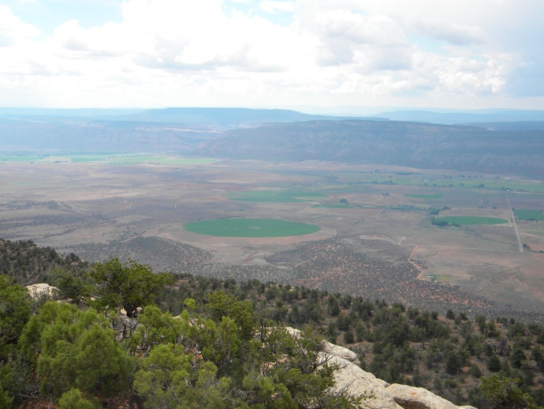
Continuing along the trail, the La Sal Mountains in Utah will come into view and you will rejoin Q13 Road. At approximately 10.4 or 10.5 miles from the highway (GPS N38 24.61 W108 56.52) you’ll be atop Carpenter Ridge, where it is strongly suggested that you stop and enjoy the view of Paradox Valley below. Paradox Valley is a collapsed salt dome, which was created when water flowing beneath the earth’s surface dissolved a subterranean layer of salt. The limestone and sandstone on top of the salt layer then collapsed, forming a valley where there was previously a dome. The valley gets its name from the fact that the Dolores River paradoxically runs across it (north-south), instead of along it (east-west). The Hell that was Paradox, by Howard Greager makes for interesting reading about this area.
After you pass the intersection with S8 Road, the Rimrocker Trail uses the same route as the Old Paradox Trail. Years ago, cattle from Paradox Valley were driven along the Paradox Trail to the railhead in Montrose. Eventually, 600 Road (aka Carpenter Ridge Road) will be on your left (GPS N38 25.335 W108 57.89). 600 Road drops down into Paradox Valley and heads to Paradox. This community has about 50 residents and NO services (other than Sunday church services) – no gas stations, convenience stores, etc.
Beyond the intersection with 600 Road, the Rimrocker Trail continues on Q13 Road and then turns left on R3 Road, where it traverses a shelf with spectacular views of the north end of Paradox Valley. The trail then rejoins Q13 Road and continues to the Manti La Sal National Forest, where the road also known as FSR 0378. After entering the national forest, the Rimrocker Trail signs are brown instead of fluorescent green.
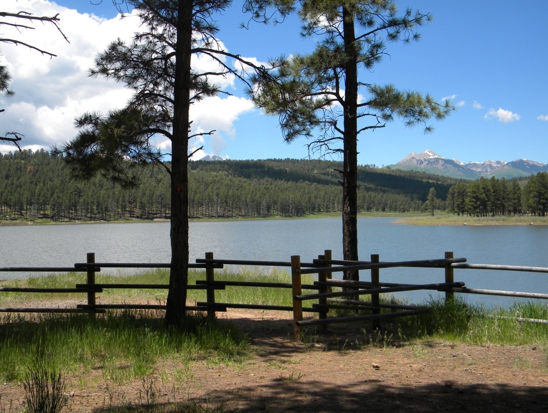
On the east side of Buckeye Reservoir is a left turn (GPS N38 26.53 W109 02.10) to a group picnic area with toilets and a wonderful view of the reservoir. Continuing on FSR 0378 (aka Q13 Road) past Buckeye Reservoir to an intersection, turn right and head northwest on FSR 0208 (aka U5 Road). At 19.4 miles from Highway 141 (GPS N38 27.33 W109 03.60) you will cross into Utah. The rest of the Rimrocker Trail, from the state line to Moab, is covered in Part 4.
4Part 4 Colorado – Utah State Line to Moab, Utah
Zero your trip meter as you cross the Utah state line. You are now on San Juan County Road 176, a wide and well-maintained road which is also known as Geyser Creek Road. Although one could imagine Geyser Creek was named for a hot geyser like those found in Yellowstone National Park, such is not the case. In reality, it was named for Al Geyser, a rancher whose cattle grazed in the area in the late 1800s. The entire area you are entering is still open range, so watch out for cattle and be cautious around corners. Also, note that all Rimrocker Trail signs in Utah are brown, regardless of changes in jurisdiction.
Continue on, ignoring lesser roads on both the left and right sides, toward the La Sal Mountains. Although the tale isn’t confirmed, these mountains were named by Spanish missionary and explorer Silvestre Valez de Escalante during his 1776 expedition. His name for them was the Sierra La Sal, or Salt Mountains, being certain that their white tops couldn’t possibly be snow in late summer.
Next, turn left onto well-maintained Two Mile Road instead of continuing on Geyser Creek Road (GPS N38 27.84 W109 06.92).
An interesting side trip would be to instead go straight and then take the Geyser Pass Road up to a saddle between Haystack Mountain and Mount Mellenthin. That saddle is known as Geyser Pass, and is also the headwaters of Geyser Creek.
At the turn onto Two Mile Road the signage indicates a connection to Highway 46, but you won’t go that far. Continue for approximately 16 miles. Part of this stretch of the trail is in the South La Sal Block of the Utah School and Institutional Trust Lands Administration (SITLA). Unlike public lands, SITLA lands are properties held in trust for eventual lease or sale. The financial proceeds from these properties support 12 state institutions, including schools, hospitals, teaching colleges, and universities. After the SITLA land, you will enter the Utah portion of the Manti-La Sal National Forest and continue past the turn for Dark Canyon Lake Road. While this road is not part of the Rimrocker Trail, you may find it interesting to explore if time allows.
On Two Mile Road at approximately 16 miles from the state line, make a right hand turn onto FSR 0073 (aka La Sal Pass Road and County Road 123). This turn is well marked and signed for La Sal Pass.
If you instead continue on Two Mile Road you’ll reach Highway 46 in about two miles. Approximately two miles west on Highway 46 is the community of La Sal. The infamous Wild Bunch gang of outlaws used La Sal as a hideout in the late 1800s, in addition to their Robbers Roost hideout near Green River. Butch Cassidy, Matt Warner, the McCarty brothers (whose last robbery was a bank in Delta, Colorado), and many others were known to have spend time in La Sal. The members of the Wild Bunch were sometimes cowboys and ranchers, in addition to being bank robbers and cattle rustlers. Perhaps their most famous robbery was the bank in Telluride, Colorado in 1893. Tom McCarty married Matt Warner’s sister. These two, along with Butch Cassidy, became known as the Invincible Three notorious outlaw gang.
Continuing on the La Sal Pass Road, the Rimrocker Trail does not go all the way to La Sal Pass (10,400’ elevation). However, that is a nice drive worth doing at another time, perhaps to see fall colors. In about another mile, at 17.1 miles from the state line, you will make a left turn at signage for Doe and Pole Canyon Trailheads (hiking trails with trailheads a little less than 2 miles ahead). This turn will place you on one of those “lesser” roads (FSR 0128) which have been not been used up to this point. FSR 0128 is rougher than Two Mile Road and La Sal Pass Road but would only be rated a 2 on a scale of 1 to 10. It is akin to an overly rough cobblestone road. At 22.2 miles and at 22.5 miles you will want to ignore side roads FSR 717 and FSR 4717. This area is remote and gets little use, so pay particular attention to both your map and signage here. See Inset 2 on the Rimrocker Trail map for details of turns in this area.
The day we drove the route the weather was cloudy and rainy, so we could only get a taste of the views in this area, primarily to the driver’s side. On a clear day these views would be spectacular, and one would be able to see a very long way.
After traversing down a switchback and heading south, turn right onto FSR 4764 (GPS N38 21.22 W109 16.09). A couple of gates will be encountered along this stretch of road. Please be respectful and leave the gates as you found them (open if were already open; closed behind you if were closed on approach). Continue along the Rimrocker Trail with turns onto FSR 4753 and FSR 4757, enjoying awesome views. After leaving the national forest and continuing through BLM land you will turn right onto Black Ridge Road, which is well maintained. Stay on this road as it skirts the west side of the La Sal Mountains in a northwesterly direction with many curves and side roads. Turn right onto Pole Canyon Road (GPS N38 23.28 W109 24.32), which is also known as BLM Road 173 and County Road 173. Follow Pole Canyon Road as it winds down toward Highway 191. At approximately 2.8 miles from the turn you will pass the main entrance to the privately owned 4×4 playground known as Area BFE (GPS N38 24.23 W109 24.48). Continue to the parking area next to Highway 191. If your vehicle is legal on highways in Utah and you are ready for pavement, a right turn leads north to Moab, and a left turn leads south to La Sal Junction. Otherwise, head northeast from the parking lot on a trail which runs parallel and next to Highway 191. See Inset 3 on the Rimrocker Trail map for details of this turn. The Rimrocker Trail diverges from the highway to follow an old railroad grade curve called Yellow Circle Road, and then makes several turns before heading north to a right turn onto Kens Lake Road. Shortly thereafter you’ll make a left turn onto the La Sal Mountain Loop Road. Head north on the La Sal Mountain Loop Road, which eventually becomes Spanish Valley Drive. Gas and other supplies are available at a Shell convenience store at the intersection of East Spanish Trail Road (a left turn) and Highway 191. The Rimrocker Trail continues north on Spanish Valley Drive and ends at the Moab city boundary, approximately 54 miles from the Colorado-Utah state line.