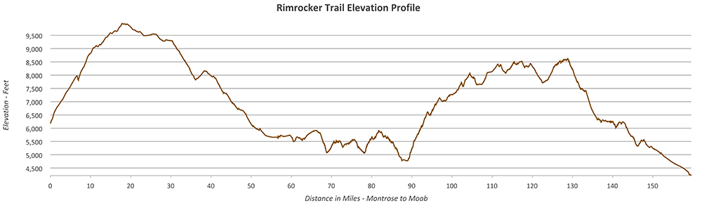
Note on elevation profile
Our GPX and KML files do not contain elevation data, and there are currently no plans in place to add elevation data to the files. Elevation data can be found when using Google Earth to view the KML file in 3D.

Our GPX and KML files do not contain elevation data, and there are currently no plans in place to add elevation data to the files. Elevation data can be found when using Google Earth to view the KML file in 3D.